Authorities in Beijing warned that parts of the Chinese capital could see more than 300 millimeters (12 inches) of rain on Monday evening, urging residents to stay indoors.
The city’s emergency management bureau issued a red rainstorm signal, the highest in its four-step warning system, at noon local time. Rains are expected to intensify beginning at 8 p.m., raising the risk of landslides in mountainous areas and waterlogging elsewhere as precipitation falls on already-soaked ground. The national weather bureau has warned of a high risk of river floods and flash floods in parts of northern Beijing.
The downpours began over the weekend, shutting major tourist sites and suspending public transport services. More than 3,000 residents were evacuated on Sunday from the suburban and mountainous Miyun District, about two hours’ drive from downtown Beijing, according to local media.
An area of low pressure high in the atmosphere — known as an upper-level trough — and the outer bands of an approaching tropical storm are driving the heavy rains in Beijing, according to the city’s meteorological service.
The torrential downpours in Beijing are set to ease off slightly from Tuesday morning. The rains will then shift to the vicinity of Shanghai, Hangzhou and Nanjing, as Tropical Storm Co-may nears the eastern coast of China. The storm last week struck the Philippines as a typhoon, weakened as it tracked north toward the East China Sea over the weekend, before regaining strength.
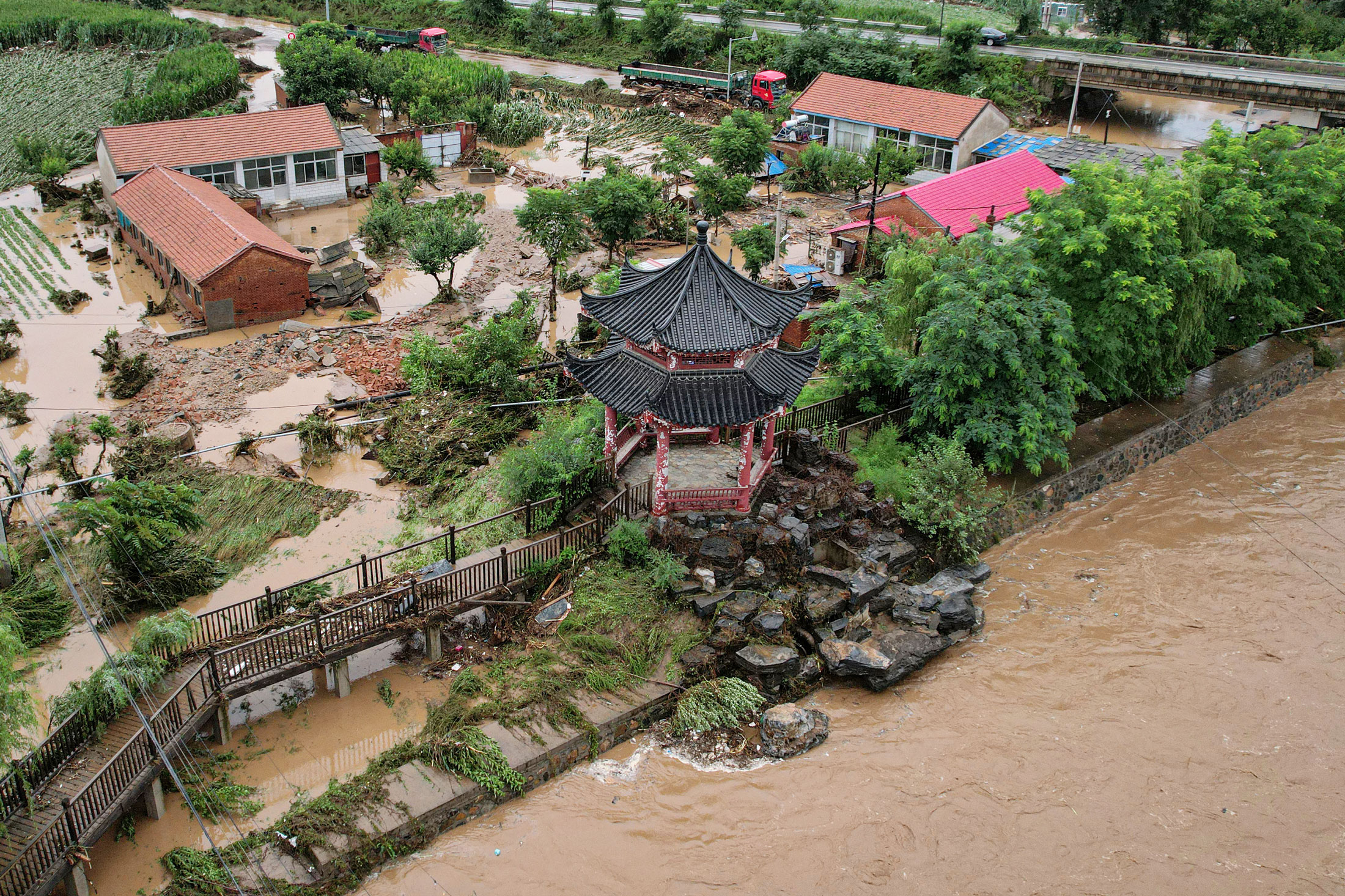
Top photo: Damaged buildings after heavy rains in Xin’anzhuang, on the outskirts of Beijing, on July 28. Photographer: Jade Gao/Getty Images.
Copyright 2025 Bloomberg.
Was this article valuable?
Here are more articles you may enjoy.

Want to stay up to date?
Get the latest insurance news
sent straight to your inbox.